Jakarta
Daerah Khusus Ibu Kota Jakarta |
| Special Capital Territory of Jakarta |
|
(From top, left to right): Jakarta Old Town, Hotel Indonesia Roundabout, Jakarta Skyline, Gelora Bung Karno Stadium, Taman Mini Indonesia Indah, Monumen Nasional, Merdeka Palace, Istiqlal Mosque |

Seal |
|
| Nickname(s): The Big Durian |
Motto: Jaya Raya (Indonesian)
(Victorious and Great) |
|
Location of Jakarta in Indonesia
|
Coordinates:  6°12′S 106°48′E / 6.2°S 106.8°E / -6.2; 106.8Coordinates: 6°12′S 106°48′E / 6.2°S 106.8°E / -6.2; 106.8 6°12′S 106°48′E / 6.2°S 106.8°E / -6.2; 106.8Coordinates: 6°12′S 106°48′E / 6.2°S 106.8°E / -6.2; 106.8 |
| Country |
Indonesia |
| Province |
Jakarta ˡ |
| Government |
| • Type |
Special administrative area |
| • Governor |
Fauzi Bowo |
| Area |
| • City |
740.28 km2 (285.82 sq mi) |
| • Land |
662.33 km2 (255.73 sq mi) |
| • Water |
6,977.5 km2 (2,694.0 sq mi) |
| Elevation |
7 m (23 ft) |
| Population (Nov 2011) |
| • City |
10,187,595 |
| • Density |
15,342/km2 (39,740/sq mi) |
| • Metro |
28,019,545 |
| • Metro density |
4,383/km2 (11,350/sq mi) |
| Time zone |
WIB (UTC+7) |
| Area code(s) |
+62 21 |
| Website |
www.jakarta.go.id (official site) |
| ˡ Jakarta is not part of any province, it is controlled directly under the government and is designated a Special Capital Territory |
Jakarta (
 /dʒəˈkɑrtə/
), officially known as the
Special Capital Territory of Jakarta (
Indonesian:
Daerah Khusus Ibu Kota Jakarta), is the capital and largest city of
Indonesia. Located on the northwest coast of
Java, Jakarta is the country's economic, cultural and political centre, and with a population of 10,187,595 as of November 2011
, it is the
most populous city in Indonesia and in Southeast Asia, and is the
twelfth-largest city in the world. The official metropolitan area, known as
Jabodetabekjur, is the
second largest in the world, yet the city's suburbs still continue beyond it. Jakarta is listed as a
global city in the 2008 Globalization and World Cities Study Group and Network (GaWC) research.
and has an area of 661 square kilometres (255 sq mi)
Based on Brooking Institute survey about growth, in 2011 Jakarta
ranked 17th among the world's 200 largest cities, a significant jump
from 2007 when Jakarta ranked 171st. Jakarta has seen more rapid growth
than
Kuala Lumpur, Beijing and
Bangkok.
Established in the fourth century, the city became an important trading port for the
Kingdom of Sunda. It was the de facto capital of the
Dutch East Indies
(when it was known as Batavia) and has continued as the capital of
Indonesia since the country's independence was declared in 1945.
The city is the seat of the
ASEAN Secretariat. Jakarta is served by the
Soekarno-Hatta International Airport,
Halim Perdanakusuma International Airport, and
Tanjung Priok Harbour; it is connected by several
intercity and
commuter railways, and served by several
bus lines running on reserved
busways.
Etymology
The site which nowadays is referred to as Jakarta, has been home to multiple
settlements along with their respective names:
Sunda Kelapa (397–1527),
Jayakarta (1527–1619),
Batavia (1619–1949), and
Djakarta (1949–1972).
Its current name is derived from the word "Jayakarta". The origins of this word lie in the
Old Javanese and thus ultimately in the
Sanskrit language. "Jayakarta" translates as "victorious deed", "complete act", or "complete victory".
Jakarta is nicknamed
Big Durian, because the city is seen as the Indonesian equivalent of New York City (the Big Apple).
History
Pre-colonial era
The area in and around modern Jakarta was part of the fourth century
Sundanese kingdom of
Tarumanagara, one of the oldest
Hindu kingdoms in Indonesia.
[6] Following the decline of Tarumanagara, its territories, including the Jakarta area, became part of the
Kingdom of Sunda. From 7th to early 13th century port of Sunda is within the sphere of influence of
Srivijaya maritime empire. According to the Chinese source,
Chu-fan-chi, written circa 1200,
Chou Ju-kua reported in the early 13th century Srivijaya still ruled Sumatra, the Malay peninsula, and western Java (
Sunda). The source reports the port of Sunda as strategic and thriving,
pepper from Sunda being among the best in quality. The people worked in agriculture and their houses were built on wooden piles.
[7] The harbour area became known as
Sunda Kelapa and by the fourteenth century, it was a major trading port for Sunda kingdom.
The first European fleet, four
Portuguese ships from
Malacca, arrived in 1513 when the Portuguese were looking for a route for spices.
[8] The Kingdom of Sunda
made an alliance treaty with Portugal by allowing the Portuguese to build a port in 1522 in order to defend against the rising power of the
Sultanate of Demak from central Java.
[9] In 1527,
Fatahillah,
a Javanese general from Demak attacked and conquered Sunda Kelapa,
driving out the Portuguese. Sunda Kelapa was renamed Jayakarta,
[9] and became a fiefdom of the
Sultanate of Banten which became a major Southeast Asia trading center.
Through the relationship with Prince Jayawikarta from the
Sultanate of Banten, Dutch ships arrived in Jayakarta in 1596. In 1602, the
English East India Company's first voyage, commanded by
Sir James Lancaster, arrived in
Aceh
and sailed on to Banten where they were allowed to build a trading
post. This site became the center of English trade in Indonesia until
1682.
[10]
Jayawikarta is thought to have made trading connections with the
English merchants, rivals of the Dutch, by allowing them to build
houses directly across from the Dutch buildings in 1615.
[11]
Colonial era
When relations between Prince Jayawikarta and the Dutch
deteriorated, Jayawikarta's soldiers attacked the Dutch fortress.
Prince Jayakarta's army and the English were defeated by the Dutch, in
part owing to the timely arrival of
Jan Pieterszoon Coen
(J.P. Coen). The Dutch burned the English fort, and forced the English
to retreat on their ships. The victory consolidated Dutch power and in
1619 they renamed the city Batavia.
Commercial opportunities in the capital of the Dutch colony
attracted Indonesian and especially Chinese immigrants. This sudden
population increase created burdens on the city. Tensions grew as the
colonial government tried to restrict Chinese migration through
deportations. On 9 October 1740, 5,000 Chinese were
massacred by the Dutch and the following year, Chinese inhabitants were moved to
Glodok outside the city walls.
[12]
The city began to move further south as epidemics in 1835 and 1870
encouraged more people to move far south of the port. The Koningsplein,
now
Merdeka Square was completed in 1818, the housing park of
Menteng was started in 1913,
[13] and
Kebayoran Baru was the last Dutch-built residential area.
[12] By 1930 Batavia had more than 500,000 inhabitants,
[14] including 37,067 Europeans.
[15]
During World War II, the city was renamed from Batavia to "Jakarta"
(short form of Jayakarta) by the Indonesian nationalists after
conquering the city from the Dutch in 1942 with the help of the
Japanese forces.
[16][clarification needed]
Independence era
Following World War II, Indonesian Republicans withdrew from
Allied-occupied Jakarta during
their fight for Indonesian independence and established their capital in
Yogyakarta. In 1950, once independence was secured, Jakarta was once again made the national capital.
[12] Indonesia's founding president,
Sukarno,
envisaged Jakarta as a great international city, and instigated large
government-funded projects with openly nationalistic and
modernist architecture.
[17][18] Projects included a clover-leaf highway, a major boulevard (Jalan MH Thamrin-Sudirman), monuments such as
The National Monument,
Hotel Indonesia, a shopping centre, and a new parliament building. In October 1965, Jakarta was the site of
an abortive coup attempt in which 6 top generals were killed, precipitating
a violent anti-communist purge in which half-a million people were killed, including many ethnic Chinese,
[19] and
the beginning of Suharto's New Order. A monument stands
where the generals' bodies were dumped.
In 1966, Jakarta was declared a "special capital city district" (
daerah khusus ibukota), thus gaining a status approximately equivalent to that of a state or province.
[20] Lieutenant General
Ali Sadikin served as Governor from the mid-60's commencement of the "
New Order"
through to 1977; he rehabilitated roads and bridges, encouraged the
arts, built several hospitals, and a large number of new schools. He
also cleared out slum dwellers for new development projects—some for
the benefit of the Suharto family
[21][22]—and
tried to eliminate rickshaws and ban street vendors. He began control
of migration to the city in order to stem the overcrowding and poverty.
[23] Foreign investment contributed to a real estate boom which changed the face of the city.
[24]
The boom ended with the
1997/98 East Asian Economic crisis putting Jakarta at the center of violence, protest, and political maneuvering. After 32 years in power, support from
President Suharto began to wane. Tensions reached a peak in when four students were
shot dead at
Trisakti University by security forces;
four days of riots and violence ensued that killed an estimated 1,200, and destroyed or damaged 6,000 buildings.
[25] Much of the rioting targeted
Chinese Indonesians.
[26] Suharto resigned as president, and Jakarta has remained the focal point of democratic change in Indonesia.
[27] Jemaah Islamiah-connected bombings occurred almost annually in the city between 2000 and 2005,
[12] with
another bombing in 2009.
[28]
Administration
Kota or kotamadya (cities) and regency of Jakarta

Map of the cities (
kotamadya) in Jakarta province. Each city is divided into subdistricts (
kecamatan).
Officially, Jakarta is not a city, but a
province with special status as the capital of
Indonesia.
It has a governor (instead of a mayor), and is divided into several
sub-regions with their own administrative systems. As a province, the
official name of Jakarta is
Daerah Khusus Ibukota Jakarta ("Special Capital City District of Jakarta"), which in Indonesian is abbreviated to DKI Jakarta.
Jakarta is divided into five
kota or
kotamadya ("cities" – formerly municipalities), each headed by a mayor – and one
regency (
kabupaten) headed by a
regent.
In August 2007, Jakarta held its first ever election to choose a
governor, whereas previously the city's governors were appointed by the
local house of representatives. The poll is part of a country-wide
decentralization drive, allowing for direct local elections in several
areas.
[29]
The cities/municipalities of Jakarta are:
- Central Jakarta (Jakarta Pusat)
is Jakarta's smallest city and home to most of Jakarta's administrative
and political center. It is characterized by large parks and Dutch
colonial buildings. Landmarks include the National Monument (Monas), the Istiqlal Mosque, the Jakarta Cathedral, and museums.[30]
- West Jakarta (Jakarta Barat)
has the highest concentration of small-scale industries in Jakarta. The
area includes Jakarta's Chinatown and landmarks include the Chinese
Langgam building and the Toko Merah building. West Jakarta contains
part of the Jakarta Old Town.[31]
- South Jakarta (Jakarta Selatan),
originally planned as a satellite city, is now the location of large
upscale shopping centres and affluent residential areas. Jakarta
Selatan functions as Jakarta's ground water buffer,[32]
but recently the green belt areas are threatened by new developments.
Much of the CBD area of Jakarta is concentrated in Setia Budi, South
Jakarta, bordering the Tanah Abang/Sudirman area of Central Jakarta.
- East Jakarta (Jakarta Timur) territory is characterized by several industrial sectors erected in this city.[33] There are also still some areas of swamps and rice fields in this city.[33]
- North Jakarta (Jakarta Utara) is the only city in Jakarta that is bounded by the sea (Java Sea). It is the location of the Tanjung Priok Port. Large-scale and medium-scale industries are concentrated in North Jakarta. North Jakarta contains part of Jakarta Old Town, formerly known as Batavia since the 17th century, and was a centre of VOC trade activity in Dutch East Indies. Also located in North Jakarta is Ancol Dreamland (Taman Impian Jaya Ancol), currently the largest integrated tourism area in South East Asia.[34]
The only regency (
kabupaten) of Jakarta is:
- Thousand Islands (Kepulauan Seribu), formerly a subdistrict
of North Jakarta, is a collection of 105 small islands located on Java
Sea. It has a high conservation value because of its unique and special
ecosystems. Marine tourism, such as diving, water bicycle, and wind
surfing, is the most important touristic activity in this territory.
The main transportation between these islands are speed boat or small
ferries.[35]
Jakarta's Cities/Municipalities (Kota Administrasi/Kotamadya)
| South Jakarta (Jakarta Selatan) |
141.27 |
2,057,080 |
14,561 |
| East Jakarta (Jakarta Timur) |
188.03 |
2,687,027 |
14,290 |
| Central Jakarta (Jakarta Pusat) |
48.13 |
898.883 |
18,676 |
| West Jakarta (Jakarta Barat) |
129.54 |
2,278,825 |
17,592 |
| North Jakarta (Jakarta Utara) |
146.66 |
1,645,312 |
11,219 |
| Thousand Islands (Kepulauan Seribu) |
8.7 |
21,071 |
2,422 |
Government
In September 1945, the government of Jakarta City was changed from the Japanese
Djakarta Toku-Betsu Shi
into the Jakarta National Administration. This first government was
held by a Mayor until the end of 1960 when the office was changed to
that of a Governor. The last mayor of Jakarta was
Sudiro, until he was replaced by Dr
Sumarno as Governor of the province (as the city had now become).
In 1974, Based on the
Act No. 5 of 1974 relating to the
Fundamentals of Regional Government, Jakarta was confirmed as the
capital of Indonesia and one of Indonesia's 26 provinces.
[36]
Municipal finances
The ability of the regional government to respond to the many
problems of Jakarta is constrained by extremely limited finances. In
2012, the total budget available to the Jakarta regional government is
expected to be around Rp 36 trillion (about $US 4 billion), equivalent
to around $US 350 per citizen. Priority areas of spending are expected
to be education, transport, flood control measures, environment
programs, and various types of social spending (such as housing).
The Jakarta provincial government, like all other provincial
governments in Indonesia, relies on transfers from the central
government for the bulk of budget income. Local (non-central
government) sources of revenue are incomes from various taxes such as
vehicle ownership and vehicle transfer fees and so on.
[37]
In recent years, the Jakarta provincial government has consistently
run a surplus of between 15-20% of total planned spending, largely
because of delays in procurement procedures and other inefficiencies in
the spending process. The regular underspending is a matter of frequent
public comment but the legal and administrative blockages that cause
the underspending problem seem very difficult to overcome.
[38]
Geography and climate
Geography
Jakarta is located on the northwest coast of
Java, at the mouth of the
Ciliwung River on
Jakarta Bay, which is an inlet of the
Java Sea. Officially, the area of the Jakarta Special District is 662 km
2 of land area and 6,977 km
2 of sea area.
[39] Jakarta lies in a low, flat basin, averaging 7 metres (23 ft)
above sea level;
[citation needed] 40% of Jakarta, particularly the northern areas, is below sea level,
[40] while the southern parts are comparatively hilly. Rivers flow from the
Puncak highlands to the south of the city, across the city northwards towards the Java Sea; the most important
[clarification needed] is the
Ciliwung River, which divides the city into the western and eastern principalities. Other rivers include the Pesanggrahan, and Sunter.
These rivers, combined with Jakarta's low topography make it prone
to flooding from swollen rivers in the wet season and high sea tides.
Other contributing factors include clogged sewage pipes and waterways
that service an increasing population, in addition to
deforestation near rapidly urbanizing
Bogor and
Depok
in Jakarta's hinterland. Furthermore, Jakarta is an urban area with
complex socio-economic problems that indirectly contribute to
triggering a flood event.
[41] Major floods occurred in 1996
[42][43] when 5,000 hectares of land were flooded
[44] and 2007.
[45]
Losses from infrastructure damage and state revenue were at least
5.2 trillion rupiah (572 million US dollars) and at least 85 people
were killed
[46] and about 350,000 people forced from their homes.
[47] Approximately 70% of Jakarta's total area was flooded with water up to four meters deep in parts of the city.
[48][49]
In May 2011, the Jakarta Environmental Management Agency categorized
all rivers in Jakarta as polluted; 71% of them were heavily polluted,
20% were partly polluted and 9% were lightly polluted.
[50]
East Flood Canal (BKT) in eastern Jakarta was a national project
which began in 2003 and late 2009 reached the Java sea and will be
accomplished in 2011. It was 23.5 kilometers length which linking five
rivers: Cipinang, Sunter, Buaran, Jati Kramat and Cakung. It will
reduce flood and hope as a 2 kilometers rowing sport venue too.
[51] To ease from flood, Jakarta Emergency Dredging Innitiave (JEDI) phase-2 will make underground canal (
siphon) from Ciliwung river to
Cipinang river and then go through to East Flood Canal. It will lowering flood at
Cawang,
Kampung Melayu,
Bukit Duri and
Kebun Baru. The length will be one kilometer and will be finished at 2016.
[52]
Besides flood from the rivers, Jakarta is also sinking about 5 to 10
centimeters each year and up to 20 centimeters in northern Jakarta
mainland. To solve it, the
Netherlands will give $4 million for a feasibility study to build a
dike
on Jakarta Bay. The ring dike will be provided with pumping system and
retention area, would regulate and control seawater and use also as
additional toll road. The project will be built by 2025.
[53]
The
Thousand Islands, which are administratively a part of Jakarta, are located in Jakarta Bay north of the city.
The view of Central Jakarta from the viewing tower at the National Monument
Climate
Jakarta has a hot and humid
tropical monsoon climate (Aw) according to the
Köppen climate classification system. Despite being located relatively close to the equator, the city has distinct
wet and
dry
seasons. Wet seasons in Jakarta cover the majority of the year, running
from November through June. The remaining four months forms the city’s
dry season. Located in the western-part of Indonesia, Jakarta's wet
season rainfall peak is January with average monthly rainfall of 389
millimetres (15.3 in), and its dry season low point is September with a
monthly average of 30 millimetres (1.2 in).
| [hide]Climate data for Jakarta |
| Month |
Jan |
Feb |
Mar |
Apr |
May |
Jun |
Jul |
Aug |
Sep |
Oct |
Nov |
Dec |
Year |
| Average high °C (°F) |
31.5
(88.7) |
32.3
(90.1) |
32.5
(90.5) |
33.5
(92.3) |
33.5
(92.3) |
34.3
(93.7) |
33.3
(91.9) |
33.0
(91.4) |
32.0
(89.6) |
31.7
(89.1) |
31.3
(88.3) |
32.0
(89.6) |
31.8
(89.2) |
| Average low °C (°F) |
24.2
(75.6) |
24.3
(75.7) |
25.2
(77.4) |
25.1
(77.2) |
25.4
(77.7) |
24.9
(76.8) |
25.1
(77.2) |
24.9
(76.8) |
25.5
(77.9) |
25.5
(77.9) |
24.9
(76.8) |
24.9
(76.8) |
24.8
(76.6) |
| Precipitation mm (inches) |
389.7
(15.343) |
309.8
(12.197) |
100.3
(3.949) |
257.8
(10.15) |
139.4
(5.488) |
83.1
(3.272) |
30.8
(1.213) |
34.2
(1.346) |
30.0
(1.181) |
33.1
(1.303) |
175.0
(6.89) |
123.0
(4.843) |
1,706.2
(67.173) |
| Avg. rainy days |
26 |
20 |
15 |
18 |
13 |
17 |
5 |
5 |
6 |
9 |
22 |
12 |
168 |
| Source: World Meteorological Organisation[54] |
Culture
As the economic and political capital of Indonesia, Jakarta attracts
many domestic immigrants who bring their various languages, dialects,
foods and customs.
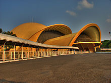
The Golden Snail (Keong Emas), established in 1970s during New Order era, is an IMAX theater located in
Taman Mini Indonesia Indah, East Jakarta.
The "
Betawi" (
Orang Betawi, or "people of Batavia") is a term used to describe the descendants of the people living in and around
Batavia
and recognized as an ethnic group from around the 18th–19th century.
The Betawi people are mostly descended from various Southeast-Asian
ethnic groups brought or attracted to Batavia to meet labor needs, and
include people from different parts of
Indonesia.
[55] The
language and Betawi culture are distinct from those of the
Sundanese or
Javanese. The language is mostly based on the East
Malay dialect and enriched by
loan words
from Dutch, Portuguese, Sundanese, Javanese, Chinese, and Arabic.
Nowadays, the Jakarta dialect (Bahasa Jakarta), used as a street
language by people in Jakarta, is loosely based on the
Betawi language.
Betawi arts have a low profile in Jakarta, and most Betawi have
moved to the suburbs of Jakarta, displaced by new migrants. It is
easier to find Java- or Minang-based wedding ceremonies rather than
Betawi weddings in Jakarta. It is easier to find Javanese Gamelan
instead of
Gambang Kromong (a mixture between Betawi and Chinese music) or
Tanjidor (a mixture between Betawi and Portuguese music) or
Marawis (a mixture between Betawi and Yaman music). However, some festivals such as the
Jalan Jaksa Festival or
Kemang Festival include efforts to preserve Betawi arts by inviting artists to give performances.
[56]
There has been a significant
Chinese community in Jakarta for many centuries. The Chinese in Jakarta traditionally reside around old urban areas, such as
Jakarta Kota,
Pluit and
Glodok
(Jakarta Chinatown) areas. They also can be found in old chinatowns of
Senen and Jatinegara. Officially, they make up 6% of the Jakartan
population, although this number may be under-reported.
[57] Chinese culture also had influenced Betawi culture, such as the popularity of Chinese cakes and sweets,
firecrackers, to Betawi wedding attire that demonstrates Chinese and Arab influences.
Jakarta has several performing art centers, such as the
Taman Ismail Marzuki (TIM) art center in Cikini,
Gedung Kesenian Jakarta near Pasar Baru, Balai Sarbini in Plaza Semanggi area,
Bentara Budaya Jakarta in Palmerah area,
Pasar Seni (Art Market) in
Ancol, and traditional Indonesian art performances at the pavilions of some provinces in
Taman Mini Indonesia Indah. Traditional music is often found at high-class hotels, including
Wayang and
Gamelan performances. Javanese
Wayang Orang performances can be found at Wayang Orang Bharata theater near
Senen
bus terminal. As the nation's largest city and capital, Jakarta has
lured much national and regional talent who hope to find a greater
audience and more opportunities for success.
Jakarta hosts several prestigious art and culture festivals, and exhibitions, such as the annual
Jakarta International Film Festival (JiFFest),
Jakarta International Java Jazz Festival,
Jakarta Fashion Week,
Jakarta Fashion & Food Festival (JFFF), Indonesia Creative Products
and Jakarta Arts and Crafts exhibition. Flona Jakarta is a
flora-and-fauna exhibition, held annually in August at Lapangan Banteng
Park, featuring flowers, plant nurseries, and pets. The
Jakarta Fair
is held annually from mid-June to mid-July to celebrate the anniversary
of the city and is largely centered around a trade fair. However this
month-long fair also features entertainment, including arts and music
performances by local bands and musicians.
Several foreign art and culture centers are also established in
Jakarta, and mainly serve to promote culture and language through
learning centers, libraries, and art galleries. Among these foreign art
and cultural centers are
China Confucius Institute,
Netherlands Erasmus Huis, UK
British Council, France Centre Culturel Français, Germany
Goethe-Institut,
Japan Foundation, and the
Jawaharlal Nehru Indian Cultural Center.
Museums
The museums in Jakarta cluster around the
Central Jakarta Merdeka Square area,
Jakarta Old Town, and
Taman Mini Indonesia Indah.
The Jakarta Old Town contains museums that are former institutional buildings of Colonial Batavia. Some of these museums are:
Jakarta History Museum (former City Hall of Batavia),
Wayang Museum (Puppet Museum) (former Church of Batavia), the
Fine Art and Ceramic Museum (former Court House of Justice of Batavia), the
Maritime Museum (former
Sunda Kelapa warehouse), Bank Indonesia Museum (former Javasche Bank), and Bank Mandiri Museum (former
Nederlandsche Handels Maatschappij).
Several museums clustered in central Jakarta around the Merdeka Square area include:
National Museum of Indonesia (also known as
Gedung Gajah ("the Elephant Building"),
Monas (National Monument), Istiqlal Islamic Museum in Istiqlal mosque, and
Jakarta Cathedral Museum on the second floor of Jakarta Cathedral. Also in the central Jakarta area is the
Taman Prasasti Museum (former cemetery of Batavia), and
Textile Museum in Tanah Abang area.
The recreational area of
Taman Mini Indonesia Indah in
East Jakarta contains fourteen museums, such as
Indonesia Museum,
Purna Bhakti Pertiwi Museum,
Asmat Museum,
Bayt al-Qur'an Islamic Museum, Pusaka (heirloom) Museum, and other
science-based museum such as Research & Technology Information
Centre, Komodo Indonesian Fauna Museum, Insect Museum, Petrol and Gas
Museum, plus the Transportation Museum.
Other museums are Satria Mandala Military Museum, Museum
Sumpah Pemuda, and
Lubang Buaya.
[edit] Cuisine
Jakarta has a vast range of food available at hundreds of eating
complexes located all over the city, from modest street-side foodstalls
and traveling vendors to the high-class expensive restaurants. The
traditional
Padang restaurants and low-budget
Javanese Warteg (
Warung Tegal) foodstalls are ubiquitous in the capital. Next to a myriad of selections of
Indonesian food and regional specialties from all over Indonesia, there is also international food, especially
Chinese,
Japanese,
Korean,
Thai,
Indian,
American,
French, Middle Eastern, and modern fusion food.
[58] One of the most popular local dishes in Jakarta is
Soto Betawi, which is a cow milk or coconut milk broth with beef tendons, intestines,
tripe. The other popular foods include:
kerak telor,
gado-gado,
sate,
nasi goreng and kue cucur.
Media
Daily newspapers in Jakarta include
- Chinese language national newspaper:Indonesia Shang Bao
- English language national newspaper: The Jakarta Post, The Jakarta Globe
- Indonesian language national newspaper: Kompas, Koran Tempo, Media Indonesia, Seputar Indonesia, Republika, Suara Pembaruan, Suara Karya, Sinar Harapan, Indo Pos, Jurnal Nasional, Harian Pelita
- Business newspaper: Bisnis Indonesia, Investor Daily, Kontan, Harian Neraca.
- Indonesian language local (Jakarta) newspaper: Pos Kota, Warta Kota, Koran Jakarta, Berita Kota,
- Sport newspaper: Top Skor
Television stations include:
- Government television: TVRI.
- Private national television: MNC TV, RCTI, Metro TV, Indosiar, ANTV, SCTV, Trans TV, TV ONE, Trans 7, and Global TV.
- Local television: B Channel, JakTV, O Channel, Elshinta TV, Daai TV, and Spacetoon.
- Cable television: First Media, TelkomVision
- Satellite television: Indovision, TelkomVision, Okevision, Aora TV, Yes TV
Many TV stations are analog
PAL, but some are now are converting to digital signals.
Economy, governance and infrastructure
Economy

Bank Indonesia headquarters. Jakarta's economy depends highly on service sectors, including financial, banking and trading sector.
Jakarta's economy depends heavily on financial service, trade, and
manufacturing. Industries in Jakarta include electronics, automotive,
chemicals, mechanical engineering and biomedical sciences manufacturing.
The economic growth of Jakarta in 2007 was 6.44% up from 5.95% the
previous year, with the growth in the transportation and communication
(15.25%), construction (7.81%) and trade, hotel and restaurant sectors
(6.88%).
[36]
In 2007, GRP (Gross Regional Domestic Product) was Rp. 566 trillion
(around $US 56 billion). The largest contributions to GDRP were by
finance, ownership and business services (29%); trade, hotel and
restaurant sector (20%), and manufacturing industry sector (16%).
[36] In 2007, the increase in per capita GRDP of DKI Jakarta inhabitants was 11.6% compared to the previous year
[36]
Both GRDP by at current market price and GRDP by at 2000 constant
price in 2007 for the Municipality of Central Jakarta (Jakarta Pusat),
which was Rp 146 million rupiahs and Rp 81 million rupiahs, was higher
than other municipalities in DKI Jakarta.
[36]
Governance
A new law in 2007 forbids the giving of money to beggars, buskers
and hawkers, bans squatter settlements on river banks and highways, and
prohibits spitting and smoking on public transportation. Unauthorized
people cleaning car windscreens and taking tips for directing traffic
at intersections will also be penalized. Critics of the new legislation
claim that such laws will be difficult to enforce and it tends to
ignore the desperate poverty of many of the capital's inhabitants.
[59]
Copying the idea of Singapore's Orchard Road, in 2011, Jakarta's
administration will restrict on-street parking on Hayam Wuruk Street
and Gajah Mada Street in
Central Jakarta. It will then remove illegal vendors at trotoaire and beggars from the area.
[60]
[edit] Water supply
Two private companies, PALYJA and Aetra, provide piped water supply
in the western and eastern half of Jakarta respectively under 25-year
concession contracts signed in 1998. A public asset holding company
called PAM Jaya owns the infrastructure. 80% of the water distributed
in Jakarta comes through the West Tarum Canal system from Jatiluhur
reservoir on the
Citarum River
70 km (43 mi) southeast of the city. Water supply had been privatized
by government of then President Suharto in 1998 to the French company
Suez Environnement and the British company
Thames Water
International. Both foreign companies subsequently sold their
concessions to Indonesian companies. Customer growth in the 7 first
years of the concessions had been lower than before, despite
substantial inflation-adjusted tariff increases during this period. In
2005 tariffs were frozen, leading the private water companies to cut
down on investments.
According to PALYJA in its western half of the concession the
service coverage ratio increased substantially from 34% in 1998 to 59%
in 2007 and 65% in 2010.
[61]
According to data by the Jakarta Water Supply Regulatory Body, access
in the eastern half of the city served by PTJ increased from about 57%
in 1998 to about 67% in 2004, but stagnated after that.
[62]
However, other sources cite much lower access figures for piped water
supply to houses, excluding access provided through public hydrants:
One study estimated access as low as 25% in 2005,
[63] while another source estimates it to be as low as 18.5% in 2011.
[64] Those without access to piped water supply get water mostly from wells that are often salty and polluted with bacteria.
Demography
| Year |
Population |
| 1870 |
65,000 |
| 1875 |
99,100 |
| 1880 |
102,900 |
| 1883 |
97,000 |
| 1886 |
100,500 |
| 1890 |
105,100 |
| 1895 |
114,600 |
| 1901 |
115,900 |
| 1905 |
138,600 |
| 1918 |
234,700 |
|
| Year |
Population |
| 1920 |
253,800 |
| 1925 |
290,400 |
| 1928 |
311,000 |
| 1930 |
435,184 |
| 1940 |
533,000 |
| 1945 |
600,000 |
| 1950 |
1,733,600 |
| 1959 |
2,814,000 |
| 1961 |
2,906,533 |
| 1971 |
4,546,492 |
|
| Year/Date |
Population |
| 31 October 1980 |
6,503,449 |
| 31 October 1990 |
8,259,639 |
| 30 June 2000 |
8,384,853 |
| 1 January 2005 |
8,540,306 |
| 1 January 2006 |
7,512,323 |
| June 2007 |
7,552,444 |
| 2010 |
9,588,198 |
* 2010 Population census
|
The 2010 census counted some 9.58 million people, well above all government estimates.
[65] The area of DKI Jakarta is 662.33 km
2, suggesting a population density of 14,464 people/km
2 as the ninth largest urban population density in the world.
[66] Inwards immigration tended to negate the effect of family planning programs.
[36] The population has risen from 1.2 million in 1960 to 8.8 million in 2004, counting only its legal residents.
[citation needed]
[edit] 2010 census results
The population of Greater Jakarta (
Jabodetabek Region) is 28,019,545 while that of Jabotabek, without
Depok Municipality, is 26,267,849.
[67]
However, even these definitions of Greater Jakarta are proving to be
outdated for Indonesian President Yudhoyono, who is considering
expanding the definition to include areas such as
Purwakarta and
Sukabumi,
[68]
along with a possible relocation of government functions to areas
without severe congestion, thereby improving coordination of government
agencies in the capital region. With such a definition, the population
easily surpasses 30 million based on 2010 Census figures.
[67]
Taman Lapangan Banteng (Buffalo Field Park) is located in Central Jakarta near the
Istiqlal Mosque,
Jakarta Cathedral,
and the Jakarta Central Post Office. It is about 4.5 hectares.
Initially it was called Waterlooplein of Batavia and functioned as the
ceremonial square during the
Netherlands Indies
colonial period. A number of colonial monuments and memorials erected
on the square during the colonial period were demolished during the
Sukarno era. The most notable monument in the square is the Monumen
Pembebasan Irian Barat (Monument of the Liberation of West Irian).
During the 1970s and 1980s the park was used as a bus terminal. In 1993
the park was turned into a public space again. It has become a
recreation place for people and is occasionally also used as an
exhibition place or for other events.
[69]
The Jakarta Flona (Flora dan Fauna), the flower and decoration plants
and pet exhibition, is held in this park around August annually.
Taman Mini Indonesia Indah (Miniature Park of Indonesia), in
East Jakarta, has 10 mini parks. But the most popular is The Bird Park or Aviary
Taman Suropati is located in
Menteng
city subdistrict in Central Jakarta. The park is surrounded by several
Dutch colonial buildings. Taman Suropati was known as Burgemeester
Bisschopplein during the Dutch colonial time. The park is circular
shaped with a surface area of 16,322 m2. There are several modern
statues in the park made by artists of the
ASEAN countries, which contributes to the nickname of the park
"Taman persahabatan seniman ASEAN" ("Park of the
ASEAN artists friendship").
[70] Also located in the Menteng area are the Taman Menteng and Situ Lembang pond parks. The Taman Menteng was built on the former
Persija soccer Stadium.
Taman Monas (Monas Park) or Taman Medan Merdeka (Medan Merdeka Park) is a huge square where the symbol of Jakarta,
Monas or Monumen Nasional (National Monument) is located. The enormous space was created by Dutch Governor General Herman Willem
Daendels
(1810) and was originally named Koningsplein (Kings Square). On 10
January 1993, President Soeharto initiated action for the
beautification of the square. Several features in the square are a deer
park and 33 trees that represents the 33 provinces of Indonesia.
[71]
In June 2011, Jakarta has only 10.5 percent Ruang Terbuka Hijau
(Green Open Space) and will be added to 13.94 percent Public Green Open
Space. Public Parks are include in Public Green Open Space. By 2030,
the administration also hope there are 16 percent Private Green Open
Space.
[72]
Sports
Jakarta was host to the
Asian Games in 1962,
[73] host of the
Asian Cup 2007 beside Malaysia, Thailand and Vietnam,
[74] and has hosted the regional-scale
Southeast Asian Games in 1979, 1987 and 1997. In 2011, Jakarta together with
Palembang, again host the
Southeast Asian Games.
Jakarta's most popular home football club is
Persija,
which plays its matches in their home stadium at Bung Karno Stadium.
The home match of Persija often draws its large fan – cladded with
Persija's typical orange kit – to watch the match in the main stadium.
The large spectators flocking to the main stadium usually worsen the
traffic congestion in Jakarta. Another premiere division team is
Persitara which plays its matches in the Kamal Muara Stadium in Kamal area.
The biggest stadium in Jakarta is the
Gelora Bung Karno Stadium with a capacity of 88,083 seats.
[75] The Senayan sports complex has several sport venues, including the Bung Karno soccer stadium,
Madya Stadium,
Istora Senayan, aquatic arena, baseball field, basketball court,
badminton court, a shooting range, several indoor and outdoor tennis
court and a golf driving range. The Senayan complex was built in 1959
to accommodate the Asian Games in 1962. For basketball, the
Kelapa Gading Sport Mall in
Kelapa Gading, North Jakarta, with a capacity of 7,000 seats, is the home arena of the Indonesian national basketball team.

Jakarta pedestrians, joggers and bicyclists take over the main avenue during Car-Free Day.
The Jakarta
Car-Free Days
are held monthly on every last Sunday of the month on the main avenues
of the city, Jalan Sudirman and Jalan Thamrin, from 6 am to 12 pm. The
briefer Car-Free Day which lasts from only 6 am to 9 am is held on
every other Sunday. The event invites local pedestrians to do sports
and exercise and have their activities on the streets that are normally
full of cars and traffic. Along the road from the Senayan traffic
circle on Jalan Sudirman, South Jakarta, to the "Selamat Datang"
Monument at the Hotel Indonesia traffic circle on Jalan Thamrin, all
the way north to the National Monument in Central Jakarta, cars are
cleared out for pedestrians. Morning gymnastics,
calisthenics and aerobic exercises,
futsal games,
jogging,
bicycling,
skateboarding, badminton, karate, and on-street library and musical performances take over the roads and the main parks in Jakarta.
[76]
Transportation
Jakarta is strained by transportation problems.
[77]
The city suffers a lack of urban public transport services due to
prioritized development of road networks, which were mostly designed to
accommodate private vehicles.
[78]
Most trips, however, are undertaken by non-motorized transportation
(particularly walking) and numerous modes of public or
demand-responsive transportation services.
[79]
| Transport mode |
No. trips ('000) |
% share |
| walking |
14,073 |
37.7 |
| small bus |
7,818 |
20.9 |
| motorcycle |
4,890 |
13.1 |
| sedan/MPV/SUV |
2,783 |
7.5 |
| medium bus |
2,012 |
5.4 |
| large bus |
1,224 |
3.3 |
| ojek (motorcycle taxi) |
1,073 |
2.9 |
| bicycle |
787 |
2.1 |
| school/company bus |
466 |
1.2 |
| economy train |
434 |
1.2 |
| patas AC (bus) |
422 |
1.1 |
| colt/mini cab |
298 |
0.8 |
| omprengan |
295 |
0.8 |
| bajaj |
217 |
0.6 |
| becak |
202 |
0.5 |
| pick up |
131 |
0.4 |
| taxi |
126 |
0.3 |
| express train |
39 |
0.1 |
| truck |
33 |
0.1 |
| other |
8 |
0.0 |
| total |
37,330 |
100 |
[80]
Road

Some major roads in Jakarta implemented 3 passengers in a car regulation during rush hours.
A structured road network had been developed in the early 19th century as a part of the
Java Great Post Road by
Daendels, which connects most major cities throughout
Java.
During the following decades, the road network was expanded to a great
extent, although it could not keep up with the rapidly increasing
numbers of motorized vehicles, resulting in highly congested traffic.
A notable feature of Jakarta's present road system is the
toll road network. Composed of an
inner and
outer ring road
and five toll roads radiating outwards, the network provides inner as
well as outer city connections. The outer ring road is under
construction, but it is largely in use. While 6
Jakarta Elevated Toll Roads are still in tender progress.
The five radiating toll roads are the:
Throughout the years, several attempts have been made to reduce
traffic congestion on Jakarta’s main arteries. Implemented solutions
include a 'three-in-one' rush-hour law, during which cars with fewer
than three passengers are prohibited from driving on the main avenues.
Another example is the ban on trucks passing main avenues during the
day.
[81]
[edit] Public road transportation
In 1966, an estimated 160,000
pedicabs (
becak) operated in the city; as much as 15% of Jakarta's total workforce was engaged in
becak driving. In 1971,
becak
were banned from major roads, and shortly thereafter the government
attempted a total ban, which substantially reduced their numbers but
did not eliminate them. A campaign to eliminate them succeeded in 1990
and 1991, but during the economic crisis of 1998, some returned amid
less effective government attempts to control them.
[82]
"Auto rickshaws", called
bajaj,
provide local transportation in the back streets of some parts of the
city. From the early 1940s to 1991 they were a common form of local
transportation in the city.
The
TransJakarta bus rapid transit service (known as Busway) was developed in the context of development reform (or
reformasi) and used Bogota's
TransMilenio system as a model.
[83] Jakarta's first busway line, from
Blok M to
Jakarta Kota opened in January 2004 and as of 28 December 2011, eleven out of fifteen
corridors are in use.
Although
ojeks
are not an official form of public transport, they can be found
throughout Indonesia and in Jakarta. They are especially useful on the
crowded urban roads and narrow alleyways, which other vehicles cannot
reach. In November 2011,
Taxijek was launched in Jakarta. It is essentially a taxi, but with a motorcycle instead of an automobile. Besides a
taximeter
and the company's driver identity card, the passenger has access to a
helmet, disposable shower caps to use underneath the helmet and an
extra raincoat. Contrary to common ojeks, Taxijeks are allowed to enter
gated communities and they usually charge a lower fare.
[84]
Electronic Road Pricing
Due to the city's acute gridlock, the Jakarta administration will implement
Electronic Road Pricing
in 10 districts: Tanah Abang, Menteng, Setiabudi, Tebet, Matraman,
Senen, Gambir, Tambora, Sawah Besar and Taman Sari. The projects will
initiate once it is approved by the Finance Ministry.
[85]
Railway
Long-distance railways and local tram services were first introduced
during the Dutch colonial era. While the trams were replaced with buses
in the post-colonial era,
long-distance railways continued to connect the city to its neighboring regions as well as cities throughout
Java. The surrounding cities of Jakarta are served by
KRL Jabotabek, a mass rapid transit system which serves commuters both in and around Jakarta. The major rail stations are
Gambir,
Jakarta Kota,
Jatinegara,
Pasar Senen,
Manggarai, and Tanah Abang. During rush hours, the number of passengers
greatly exceeds the system's capacity, and crowding is common.
There had been plans for a
monorail
and part of it was already under construction, but the project stalled
in 2004 and was officially abandoned as of 2008, mostly due to a lack
of investors to fund it all. If completed, the monorail would have been
made up of two lines: the green line serving Semanggi-Casablanca
Road-Kuningan-Semanggi and the blue line serving Kampung
Melayu-Casablanca Road-
Tanah Abang-
Roxy.
[86]
A
two-line metro (MRT) system
is proposed, with a north-south line between Kota and Lebak Bulus,
without connections to the cancelled monorail lines; and an east-west
line, which will connect to the north-south line at Sawah Besar
Station. In the end the JMRT would be a combination of both subways and
elevated rails. The metro system construction started in April 2012,
[87]
with the first, 15.2 km-long line between Hotel Indonesia and Lebak
Bulus, and the north-south line MRT network is scheduled to be
operational by 2016.
[88]
Jakarta Capital City Government had decided to build rail-based mass
transits because this type of transport is capable of carrying
passengers in large quantities quickly and cheaply.
[89]
Air
Soekarno-Hatta International Airport (CGK) is the main airport serving the greater Jakarta area. The airport is named after the first President of Indonesia,
Soekarno,
and the first vice-president, Mohammad Hatta. The airport is often
called Cengkareng or Soetta by Indonesians. The airport's IATA code,
CGK, originates from the name of the Cengkareng locality ,
[90]
a district situated to the northwest of the city. It is Indonesia's
busiest airport handling nearly 40 million passengers annually. A
second airport,
Halim Perdanakusuma International Airport (HLP) serves mostly private and VIP/presidential flights. Other airports in the Jabotabek metropolitan area include
Pondok Cabe Airport and an airfield on Pulau Panjang, part of the
Thousand Island archipelago.
Waterway
On 6 June 2007, the city administration introduced the Waterway (officially
Angkutan Sungai), a new river boat service along the Ciliwung River.
[77][91]
However, because of the large amount of floating garbage which kept
jamming the propeller, it is no longer in service. The varying water
levels during the dry and wet seasons were also a contributing factor
to the close-down.
Sea
Jakarta's main seaport
Tanjung Priok serves many ferry connections to different parts of Indonesia.
Tanjung Priok
is the largest seaport in Indonesia, with an annual traffic capacity of
around 45 million tonnes of cargo and 4,000,000 TEU's. The port is also
an important employer in the area, with more than 18,000 employees who
provide services to more than 18,000 ships every year. The
Port of Jakarta has 20 terminals:
general cargo,
multipurpose terminal,
scraps terminal,
passenger terminal,
dry bulk terminal,
liquid bulk terminal,
oil terminal,
chemicals terminal and three
container terminals, 76
berths, a
quay length of 16,853 metres, a total storage area of 661,822 m
2 and a storage capacity of 401,468 tonnes.
[92]
In December 2011, Muara Angke Port has been renovated yet with cost
Rp130 billion ($14.4 million) in 3 hectares area. Next, Muara Angke
Port will be used for public transport port to
Thousand Islands, while Marina
Ancol Port will be used as tourist ship port.
[93]
Education
Jakarta is home to a number of universities, of which the
University of Indonesia is the largest. It is a state-owned university with campuses in Salemba and
Depok.
[94]
STOVIA was the first high school in Jakarta, established in 1851.
[95]
As the largest city and the capital, Jakarta houses a large number of
students from various parts of Indonesia, many of whom reside in
dormitories or home-stay residences. For basic education, there are a
variety of primary and secondary schools, tagged with public (
national), private (
national and bi-lingual national plus) and
international schools. Three of the major international schools located in Jakarta are the
Gandhi Memorial International School,
Jakarta International School and the
British International School (BIS). Other international schools include the
Jakarta International Korean School,
Jakarta International Multicultural School,
[96] Australian International School,
[97] New Zealand International School,
[98] Singapore International School, and
Sekolah Pelita Harapan[99]


